You don't see the world as it is. You see it through a mental model — a simplified representation built from past experience, education, culture, and the limits of your perception. That model is extraordinarily useful. It is also not the world. The distinction between the two is the foundation of accurate thinking and the source of most serious judgment errors.
Korzybski and the Origin of the Idea
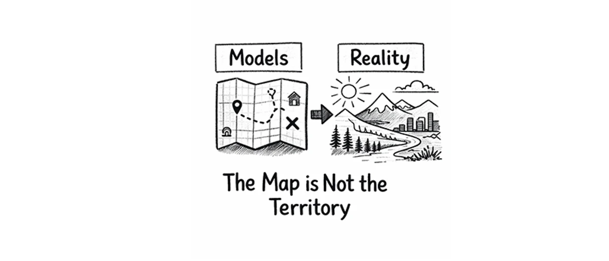
Alfred Korzybski was a Polish-American philosopher and scientist who developed General Semantics — a study of how language and symbols influence human thought and behavior. His most famous contribution, articulated in his 1933 work Science and Sanity, is the aphorism: "A map is not the territory it represents."
Korzybski's concern was with language and abstraction: he observed that human beings are unique in their capacity to create and operate on symbolic representations of reality — words, maps, models, theories, categories. This capacity is the source of human cognitive power. It is also the source of a specific class of errors: treating the representation as if it were the thing represented, and confusing the properties of the symbol with the properties of what the symbol refers to.
Korzybski's Full Formulation
"A map is not the territory it represents, but, if correct, it has a similar structure to the territory, which accounts for its usefulness."
The second half of this formulation is as important as the first. Korzybski was not arguing that maps are useless or that models are worthless. He was making a precise epistemological point: maps are useful because they have structural similarities to the territory — they capture certain relationships accurately. But they are not identical to the territory, and every map omits, simplifies, and distorts in ways that matter when the omissions, simplifications, and distortions are in the part of the territory you most need to understand.
The idea has deep roots before Korzybski. Jorge Luis Borges explored it in his story "On Exactitude in Science," imagining an empire that creates a map so detailed it is the same size as the empire itself — and therefore useless. The philosopher Josiah Royce used a map analogy to explore self-reference. In Zen Buddhism, the "finger pointing at the moon" teaching captures the same insight: don't confuse the finger (the symbol, the map) for the moon (the reality it points toward).
What "The Map Is Not the Territory" Actually Means
The metaphor applies to any mental representation of reality: your beliefs about how a person behaves, your model of how markets work, your theory of why your organization succeeds, your understanding of a scientific domain, your political ideology. All of these are maps — simplified representations of a complex territory.
The principle has several specific implications that are each practically important.
Every Map Omits
A map that included everything in the territory would be the territory — it would be useless as a navigational tool. Every map necessarily omits most of what is in the territory, retaining only what the mapmaker judged most relevant for the map's purpose. Your mental model of a person omits most of what is true about them; your economic model omits most of what is true about the economy. The omissions are features, not bugs — but they mean the map has gaps that can produce errors when the relevant information is in an omitted region.
Every Map Simplifies
Maps don't just omit — they also simplify. The relationships they represent are cleaner, more stable, and more regular than the relationships in the territory. Your model of a person treats them as having consistent traits; real people are more contextually variable. Your economic model treats agents as rational; real economic actors are bounded rationalists. The simplification is what makes the map useful. It is also what makes it wrong in the cases that don't fit the simplified model.
Every Map Has a Perspective
Maps are made from a particular standpoint for a particular purpose. A road map omits terrain details important to a hiker; a topographic map omits road information important to a driver. Your mental model of a situation was built from your particular vantage point, with your particular purposes and concerns. Someone else built a different map of the same situation from a different vantage point — and their map may be more accurate in exactly the dimensions where yours is least accurate.
Every Map Becomes Outdated
Territories change. Maps, unless updated, don't. Your model of how a market works may have been accurate five years ago and inaccurate now. Your model of how a relationship works may reflect who a person was at a particular time rather than who they are currently. Maps that were once accurate guides become misleading when the territory has changed while the map has not been updated.
Maps Are Necessary — and Necessarily Imperfect
The map-territory principle is sometimes misread as an argument against having maps — against using mental models, frameworks, and simplified representations. This misreading is itself an error. Maps are not the problem; treating them as if they were the territory is the problem.
The statistician George Box made the same point about statistical models: "All models are wrong, but some are useful." The usefulness comes from the structural similarities the model captures; the wrongness comes from the simplifications and omissions that the model requires. Both are true simultaneously, and acknowledging both is the correct relationship to any model.
The goal is not maplessness — navigating without any mental representation of the territory would be impossible. The goal is map-awareness: knowing that you're using a map, knowing the kinds of distortions and omissions your particular map tends to have, and remaining genuinely open to updating the map when territory exploration reveals that the map is wrong.
The Useful Map Standard
A useful map is one that is accurate enough for its purpose in the domain where it is being used. The question is not "is this map perfect?" but "is this map accurate enough for this navigation task?" A rough sketch may be adequate for finding a building; it would be inadequate for performing surgery. The same principle applies to mental models: the standard of accuracy required depends on the stakes of the decision and the domain where the map will be used. This is directly related to the circle of competence — your maps are most reliable in the domains where you've done the most territory exploration.
Where Maps Most Commonly Fail
Maps fail in predictable ways — not randomly, but in the specific regions where the territory is most complex, most dynamic, or most different from the territory for which the map was originally made.
At the Edges and Extremes
Maps are typically most accurate near the center of the distribution — the common cases, the typical situations, the normal range of outcomes. They are least accurate at the edges: unusual situations, extreme outcomes, tail risks. Your model of how a business performs may be accurate for normal economic conditions and systematically wrong for recessions or rapid growth. Your model of how a relationship functions may be accurate under ordinary stress and wrong under extreme stress.
This is why second-order thinking matters: the second-order effects — which are by definition unusual and often extreme — are exactly where simple maps are least reliable. And it's why Nassim Taleb's work on tail risks is so important: the events that matter most to outcomes are precisely the events that standard maps omit or underestimate.
In Novel Situations
Maps are built from past experience of the territory. In genuinely novel situations — new technologies, new market structures, new social contexts — your maps were built from a different territory than the one you're currently navigating. The experienced investor who navigated multiple market cycles has accurate maps of familiar patterns; in a genuinely unprecedented situation, those maps may be actively misleading.
This is why first principles thinking is most valuable in novel situations: it is the practice of navigating without relying on existing maps — building a fresh representation from direct observation of the territory rather than from inherited maps that may not apply.
When the Territory Changes
One of the most reliable sources of serious errors is the continued use of accurate maps in a territory that has changed. The manager whose mental model of their team was accurate two years ago may be operating from an outdated map if team dynamics, capabilities, or motivations have shifted. The investor whose model of a company was accurate before a major structural change may hold positions based on a map that no longer describes the territory.
The challenge is that maps don't come with expiration dates. They continue to feel accurate — to feel like the way things are — long after the territory has changed, because the map shapes what you notice and how you interpret what you notice. Confirmation bias keeps you attending to the observations that fit the map and filtering out the ones that don't, preventing the signal that the territory has changed from reaching the level of conscious attention.
Models in Science: Useful Fictions
Science is the most systematic human attempt to build accurate maps of the territory — and scientific history is substantially a history of discovering that existing maps are wrong in important ways and replacing them with better ones. Understanding how science relates to the map-territory distinction clarifies what good epistemic practice looks like.
Newtonian Mechanics as Map
Newtonian mechanics is an extraordinarily accurate map for the territory of everyday physical experience — objects moving at ordinary speeds, at ordinary scales, under ordinary conditions. For that territory, it remains one of the most precise and useful maps ever constructed. It is also wrong in domains where relativistic or quantum effects matter — at very high speeds, very small scales, or very strong gravitational fields. Einstein's relativity didn't invalidate Newton's mechanics; it revealed the edges of the territory where Newton's map remained accurate and identified the regions where a more accurate map was needed.
The practical lesson: a map being wrong in some domain doesn't mean it's useless in all domains. The correct response to discovering a map's limits is not to discard it but to understand which regions of the territory it maps accurately and which it doesn't.
Economic Models
Economic models are maps of how markets and economic actors behave. The standard rational actor model — in which agents have stable, consistent preferences and make optimal decisions given available information — is a useful simplification for many analytical purposes. It is also systematically wrong in ways that behavioral economics has documented extensively: real agents have inconsistent preferences, are subject to cognitive biases, and make predictably irrational decisions under specific conditions.
The behavioral economics revolution was essentially a map update: recognizing that the rational actor map was inaccurate in specific, predictable ways, and building more accurate maps that incorporated the observed patterns of human irrationality. Neither the old map nor the new one is the territory — both are useful simplifications, accurate in different domains and to different degrees.
The Pragmatist Criterion
The philosopher William James argued that the truth of a belief is best understood in terms of its practical consequences — a belief is "true" insofar as it works, insofar as it guides action successfully. This is essentially a map-territory criterion applied to epistemology: a good map is one that navigates the territory successfully, producing expected outcomes when followed. Maps are evaluated not by their correspondence to some ideal truth but by their practical accuracy in guiding navigation. This is why Munger insists on testing mental models against actual outcomes — and why a model that produces consistent errors must be revised regardless of how elegant or internally consistent it is.
Mental Models and Decision Making
Every decision is made using a map. The quality of the decision is bounded by the accuracy of the map in the domain most relevant to the decision. This makes map quality — the accuracy and appropriate scope of your mental representations — a fundamental determinant of decision quality.
The Expert's Map Problem
Experts have high-resolution maps of their domains of expertise. These maps are typically more accurate than novice maps in the domain's core territory. But expert maps have a specific failure mode: experts sometimes confuse the precision and richness of their maps with accuracy about the territory — they mistake their detailed model for a complete description of the territory rather than a sophisticated simplification of it.
This produces characteristic expert errors: overconfidence in predictions within the domain, resistance to updating when the territory departs from the expected pattern, and failure to recognize novel situations that the existing map cannot represent. The expert's rich map can become a filter that prevents certain observations from registering — because the observations don't fit the map's categories.
Maps and Investment Theses
An investment thesis is a map of a company's future — a model of its competitive position, its economics, its growth trajectory. The thesis is built from available information, and it necessarily simplifies and omits. Good investors understand this: they hold their theses as working hypotheses, not as truths about the territory. They specify in advance what observations would require the thesis to be revised and remain alert to those signals.
Poor investors treat their theses as territory descriptions rather than maps. When the territory diverges from the thesis — when the company behaves in ways the model didn't predict — they interpret the divergence as territory error rather than map error. They find reasons the data is misleading rather than updating the thesis. The confirmation bias and the map error reinforce each other: the map filters the observations, and the filtered observations confirm the map.
Strategic Plans as Maps
Business strategy is explicit map-making: a strategic plan is a model of how the competitive environment works, how customers behave, how resources should be deployed. The plan is necessarily built on assumptions — about market dynamics, customer preferences, competitive responses — that may not hold. The map-territory principle applied to strategy: the most important part of any strategic plan is not the plan itself but the explicit identification of the assumptions the plan depends on, and the monitoring systems that will detect when those assumptions are no longer accurate.
A strategy that is right until it's wrong without any mechanism for detecting the transition from right to wrong is a map without a revision process — and maps without revision processes eventually produce disasters at the moment they're most needed.
How to Update Your Maps Well
The map-territory principle implies that map updating — the revision of mental representations in response to new information — is one of the most important cognitive skills. Good map updating requires both the willingness to revise and the accuracy to revise in the right direction.
Action Steps
- Make your maps explicit. Implicit mental models are hard to update because they're hard to examine. Making your map explicit — writing down your assumptions, your model of how a situation works, what you expect to happen and why — creates something that can be compared against observations and revised when the comparison reveals mismatches.
- Identify the load-bearing assumptions. Every map has assumptions that are more central to its structure than others — the assumptions that, if wrong, would require the most substantial revision. Identifying these explicitly allows you to monitor them specifically and recognize when they're being violated.
- Specify what would falsify the map. Before deploying a map for an important decision, specify in advance what observations would require revising it. This prevents post-hoc rationalization — the tendency to explain away disconfirming observations rather than updating the map.
- Distinguish map error from territory error. When observations diverge from map predictions, there are two possibilities: the map is wrong, or the observation is wrong. The default bias is to question the observation; the map-territory principle suggests questioning the map first. Observations are raw data; the map is a constructed interpretation. Raw data is usually more reliable than constructed interpretations.
- Update proportionally, not catastrophically. Not every map-territory mismatch requires a complete map revision. Minor mismatches in peripheral regions of the map require minor updates; central mismatches require more substantial revision. Bayesian updating — revising beliefs in proportion to the strength of the new evidence — is the correct model. Both under-updating (ignoring disconfirming evidence) and over-updating (abandoning the map at the first deviation) are errors.
Goodhart's Law: When the Map Becomes the Territory
Goodhart's Law — "when a measure becomes a target, it ceases to be a good measure" — describes a specific and catastrophic form of map-territory confusion: the situation in which a map (a metric, a measure, a representation) is treated as if it were the territory, causing behavior to optimize for the map rather than the underlying reality.
GDP is a map of economic wellbeing — a simplified representation that captures certain aspects of economic activity. When GDP becomes a policy target, policy optimizes for GDP rather than for the underlying wellbeing it was meant to represent — producing policies that improve the metric while leaving the underlying reality unchanged or worsening it. Educational test scores are a map of learning; teaching to the test optimizes the map while potentially degrading the territory. Employee performance metrics are a map of productivity; optimizing for metrics produces metric-gaming behaviors that diverge from actual productivity.
The Metric Trap
Any time a proxy measure — a map of something harder to measure directly — is used to manage a system, Goodhart's Law creates pressure for the map to diverge from the territory. The more high-stakes the use of the metric, the stronger the pressure. Performance bonuses tied to specific metrics create strong incentives to optimize the metric rather than the underlying performance. This is not a failure of individual ethics — it is a structural consequence of using maps as if they were territory, creating incentives that are calibrated to the map rather than to reality.
The map-territory awareness applied to measurement: treat every metric as a proxy for something harder to measure directly, remain alert to ways the proxy might diverge from the underlying reality, and supplement quantitative metrics with direct observation of the territory they're supposed to represent. This connects directly to the second-order thinking framework — the second-order effect of making any metric into a target is typically the optimization of the metric at the expense of what the metric was measuring.
Building Map-Aware Thinking
Map-awareness — the consistent practice of distinguishing between your mental representations and the reality they represent — is a meta-cognitive skill that improves the quality of every other thinking process. It is the epistemological foundation on which the other mental models in this series rest: first principles thinking is the practice of rebuilding maps from territory observation; inversion is the practice of testing maps from the failure direction; awareness of confirmation bias is the practice of noticing when the map is filtering territory observations to confirm itself.
The Daily Map Audit
Once per week, identify one belief, model, or assumption that is guiding significant decisions and ask: when did I last test this against the actual territory? What observations would update it? Is it possible the territory has changed while this map hasn't been updated? The goal is not to doubt everything — it is to maintain a regular process of map-territory comparison that catches the gradual drift between maps and territories before it produces serious navigational errors.
The Prediction as Map Test
The most direct test of a map's accuracy is its predictive power: does the map correctly predict what you observe when you look at the territory? Making explicit predictions based on your maps — and tracking their accuracy — is the most reliable way to identify where your maps are wrong. This is the scientific method applied to personal epistemology: form hypotheses (maps), make predictions, observe territory, update the map based on prediction accuracy.
The Other Map Practice
For any important situation, deliberately construct what the territory would look like from a different map — someone with a different background, different expertise, different incentives, or different cultural context. This practice reveals the perspective-dependence of your own map: the features you've emphasized, the regions you've omitted, and the simplifications you've made. The territory looks different from different maps, and the differences are where your map is most likely to be wrong.
The Fundamental Insight
The map-territory principle is ultimately about epistemic humility — the recognition that your mental representations of reality are constructions, not direct perceptions; approximations, not truths; tools for navigation, not descriptions of essence. This humility is not debilitating skepticism. It is the accurate self-knowledge of how human cognition works: we navigate by maps, we make maps from territory observation, and the maps are always imperfect simplifications of a territory more complex than any map can capture.
The people who navigate most effectively are not the ones with the most confident maps — they are the ones who hold their maps loosely, update them regularly, remain curious about the regions where the map is least reliable, and treat every significant map-territory mismatch as valuable information rather than a threat to the map's validity. That practice, applied consistently across the full range of mental models you use, is what produces the kind of thinking that actually tracks reality rather than the kind that merely confirms what you already believed.


